When you snap a photo on a GPS enabled device such as a fancy camera or smart phone you (knowingly or unknowingly) add a little piece of information into the metadata, the latitude and longitude coordinates.

This can be great for things like location scouting or even tracking terrorist… Phillip Schmitt, who is way smarter than most people, figured out a way to create Light Painting using the information contained within these geotags by writing some code, making a phone talk to a flash and doing some other stuff I don’t really understand.
The results of his efforts are nothing short of pure light painting magic! Check out the info, video, and images below. For even more info check out Phillips website HERE!
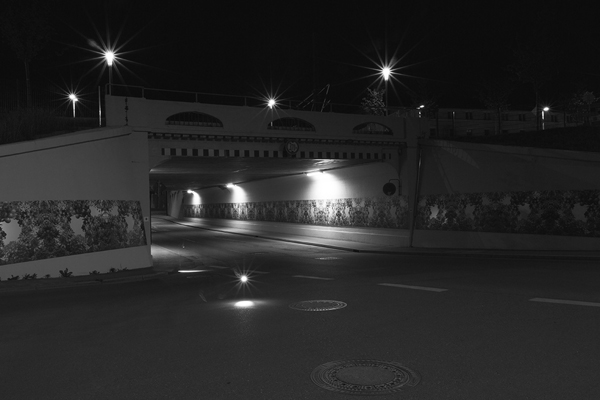
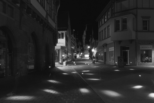
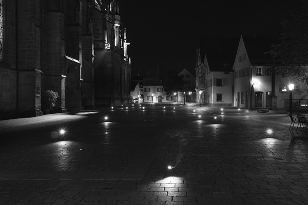
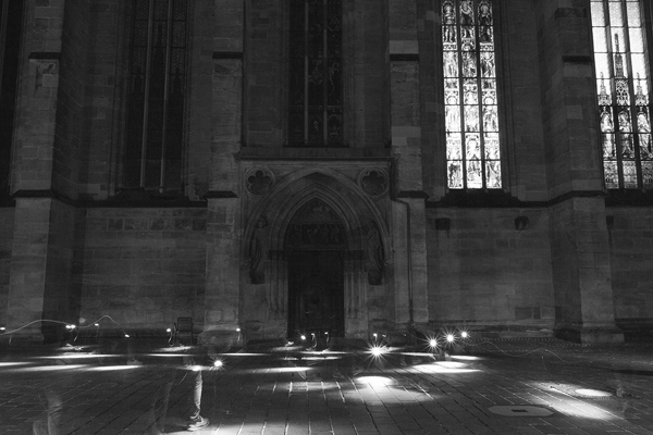
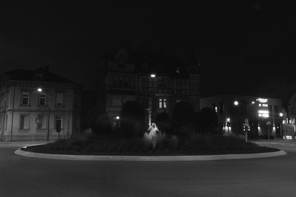
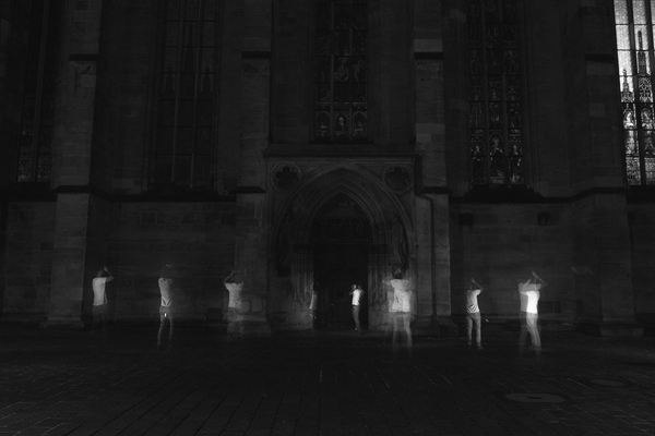
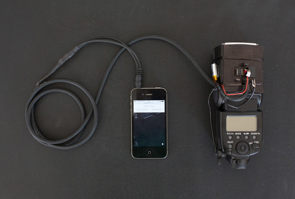
ABOUT THE PROJECT: Phillip says “I built a custom camera, flash + smartphone setup that queries the Flickr and Panoramio API for photos taken at the current geographical position. Whenever there’s a photo available, a flash is triggered. Long-exposure photographs capture multiple flash lights — each representing one geotagged photo — and situates them in the place of their origin. Using this technique, I produced two kinds of images. Those with light dots in it are mere representations of the data. The second kind has “ghost photographers” or “holograms” in it, exploring the question how it would have looked if all the photographers who uploaded their pictures had been there simultaneously.”